



Utilizziamo i cookie

Usiamo cookie per migliorare la tua esperienza, analizzare il traffico e mostrarti contenuti personalizzati. Cookie Policy · Privacy Policy

Preferenze cookie

Gestisci le tue preferenze per categoria. I cookie necessari non possono essere disattivati.

NecessariEssenziali per il funzionamento del sito. Non possono essere disabilitati.
Sempre attivi
AnalyticsCi aiutano a capire come usi il sito (Google Analytics). Tutti i dati sono anonimi.
MarketingUsati per mostrarti annunci pertinenti su Facebook e Instagram (Meta Pixel).
PreferenzeRicordano le tue scelte (lingua, layout, ecc.) per personalizzare la navigazione.
Skip to content
A coastal and cultural itinerary

57 towers.
One entire coastline.

57 Towers is a coastal itinerary connecting the ancient watchtowers of Salento, following the natural line of the Ionian and Adriatic coasts. A route that combines history, landscape and movement along one of the most varied and intense areas of the Mediterranean.
Total distance: 185 km
Stages: 57
Municipalities: 24
On foot (~24 km/day): ~8 days
By bike (~40 km/day): ~5 days

Click on a tower to see the distance from the previous one and estimated travel times on foot and by bike.

The route

A sequence of 57 vantage points

The route runs for about 185 kilometres along the Ionian and Adriatic coasts of Salento, from Torre Castiglione near Porto Cesareo to Torre Specchiolla, near Squinzano. The 57 coastal towers form a continuous line of reference along the perimeter of historic Salento, marking distances, perspectives and changes in the landscape.

It is not a single mandatory route but a navigable network: it can be tackled continuously or in fragments, choosing individual stretches or single towers according to one's own possibilities and pace.

1
Torre Castiglione
Ionian coast, shallow waters and sandy seabeds. The route begins here.
2
Torre Lapillo
Wide beaches and dunes, among the most popular on the Ionian coast.
3
Torre Chianca
Low coast with Mediterranean scrub and direct access to the sea.
4
Torre Cesarea
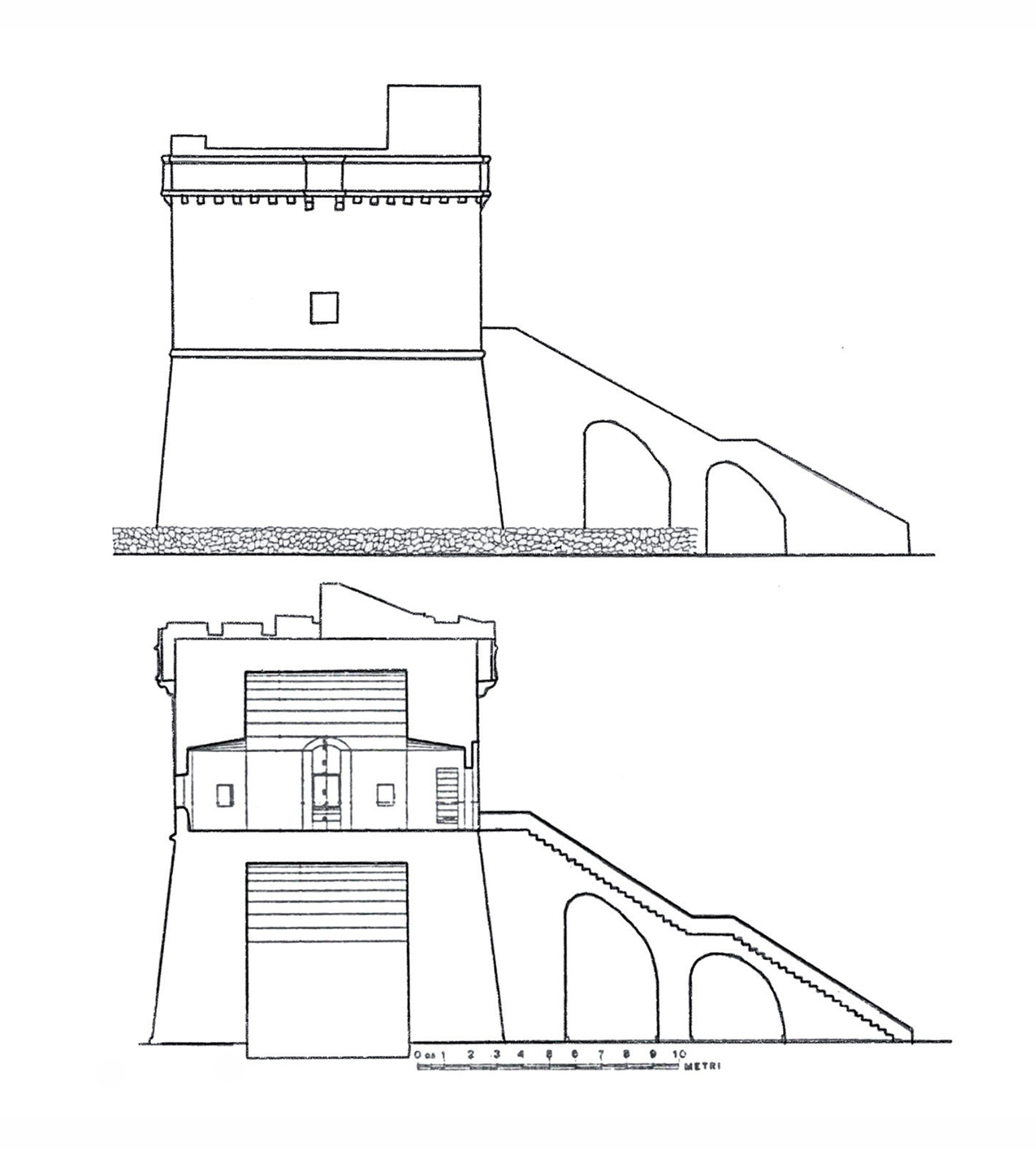
Cylindrical tower on a low promontory. Open view over the Gulf of Taranto.
5
Torre Squillace
Overlooking one of the most sheltered bays in the Nardò area.
6
Torre Sant'Isidoro
Coast with pine forest and sea access between rocks and sand.
7
Torre Inserraglio
Protected natural area, among the wildest on the Ionian side.
8
Torre Uluzzo
Prehistoric cave and 16th-century tower on the same stretch of coast.
9
Torre dell'Alto
Elevated position with a view of the gulf as far as Gallipoli.
10
Torre Santa Caterina
Small cove with shallow seabed and clear water, easy access.
11
Torre Fiume
River mouth and mixed landscape between coast and inland wetlands.
12
Torre dell'Alto Lido
Last outpost of Sannicola before entering the territory of Gallipoli.
13
Torre Sabea
North of Gallipoli, long beaches and shallow seabeds suited to any pace.
14
Torre San Giovanni La Pedata
Developed seaside area, with a long continuous stretch of beach.
15
Torre del Pizzo
Promontory south of Gallipoli. View of the historic city from the sea.
16
Torre Suda
Low coast with direct access. The landscape opens up towards the south.
17
Torre Sinfonò
Territory of Alliste. Dunes and scrub, a little-frequented stretch.
18
Torre San Giovanni Marittimo
Protected natural area of Ugento. Untouched seabeds and coastal vegetation.
19
Torre Mozza
Partially collapsed tower, melancholic landscape between dunes and sea.
20
Torre Pali
Territory of Salve. Clear waters and free beach, little development.
21
Torre Vado
Natural harbour with boats. The Ionian Salento begins to change character.
22
Torre San Gregorio
Territory of Patù, a few kilometres from the extreme point of Salento.
23
Torre Marchiello
Coast descending towards Leuca. Rocks and open sea on the Ionian side.
24
Torre dell'Omomorto
Evocative name, extreme position. The coast narrows towards the cape.
25
Torre S.M. di Leuca
The turning point. Here the Ionian Sea ends and the Adriatic begins.
26
Torre Montelungo
First Adriatic tower after Leuca. The coast changes colour and character.
27
Torre Porto di Novaglie
Small natural harbour among the high rocks of the southern Adriatic side.
28
Torre Specchia Grande
Territory of Corsano. Cliffs and rough sea, dry landscape.
29
Torre del Ricco
Rocky coast, sea access via paths and low scrub.
30
Torre Nasparo
Territory of Tiggiano. Isolated outpost on a wind-battered coast.
31
Torre del Sasso
Tricase Porto. High cliffs and natural harbour among the rocks.
32
Torre Porto di Tricase
The port of Tricase, one of the busiest on the southern Adriatic side.
33
Torre Palane
A few metres from the previous one. Two outposts close together defending the port.
34
Torre Porto di Ripa
Andrano. Small cove with fishing boats among rocky walls.
35
Torre Capo Lupo
Territory of Diso. Promontory with wide views towards Castro and the north.
36
Torre Diso
Near Castro. High coast and dark sea, rugged landscape.
37
Torre Miggiano
Santa Cesarea Terme. Start of the most spectacular stretch of the Adriatic route.
38
Torre Santa Cesarea
Sea caves and thermal waters. Liberty-style villa on the cliff.
39
Torre Specchia La Guardia
Elevated position. View of the Otranto channel as far as Albania.
40
Torre Minervino
Outpost before Otranto. The coast becomes wider and more developed.
41
Torre Porto Badisco
Legend says Aeneas landed here. Small, quiet cove.
42
Torre Sant'Emiliano
Entrance to the territory of Otranto. The coast widens towards the town.
43
Torre Palascìa
The easternmost point of Italy. Here the first sun rises over Italian territory.
44
Torre dell'Orte
North of Otranto, start of the Adriatic stretch descending towards the plain.
45
Torre del Serpe
A few minutes from the previous one. Double outpost on this windswept coast.
46
Torre Santo Stefano
Coast that opens up. Wider beaches and a landscape that changes pace.
47
Torre Fiumicelli
Last tower in the territory of Otranto. Coastal wetland with wildlife.
48
Torre Sant'Andrea
Melendugno. Low cliffs and natural pools among the rocks.
49
Torre dell'Orso
White beach and turquoise waters. One of the best-known destinations on the Adriatic Salento.
50
Torre Roca Vecchia
Archaeological site with karst cave and Bronze Age settlement.
51
Torre San Foca
Port and beach. Entrance to the most urbanised stretch of the Adriatic coast.
52
Torre Specchia Ruggeri
Last tower of Melendugno. The route enters the territory of Lecce.
53
Torre San Cataldo
Port and seaside town. The Salento capital reaches the sea here.
54
Torre Veneri
Coastal nature park. Protected dunes and regulated access to the sea.
55
Torre Chianca
Coast stretching towards the north. The landscape becomes quieter.
56
Torre Rinalda
Second-to-last tower. Long beach and fine sand, the towers are about to end.
57
Torre Specchiolla
The last sentinel of Salento closes a five-century-old route.
The history

Why they were built

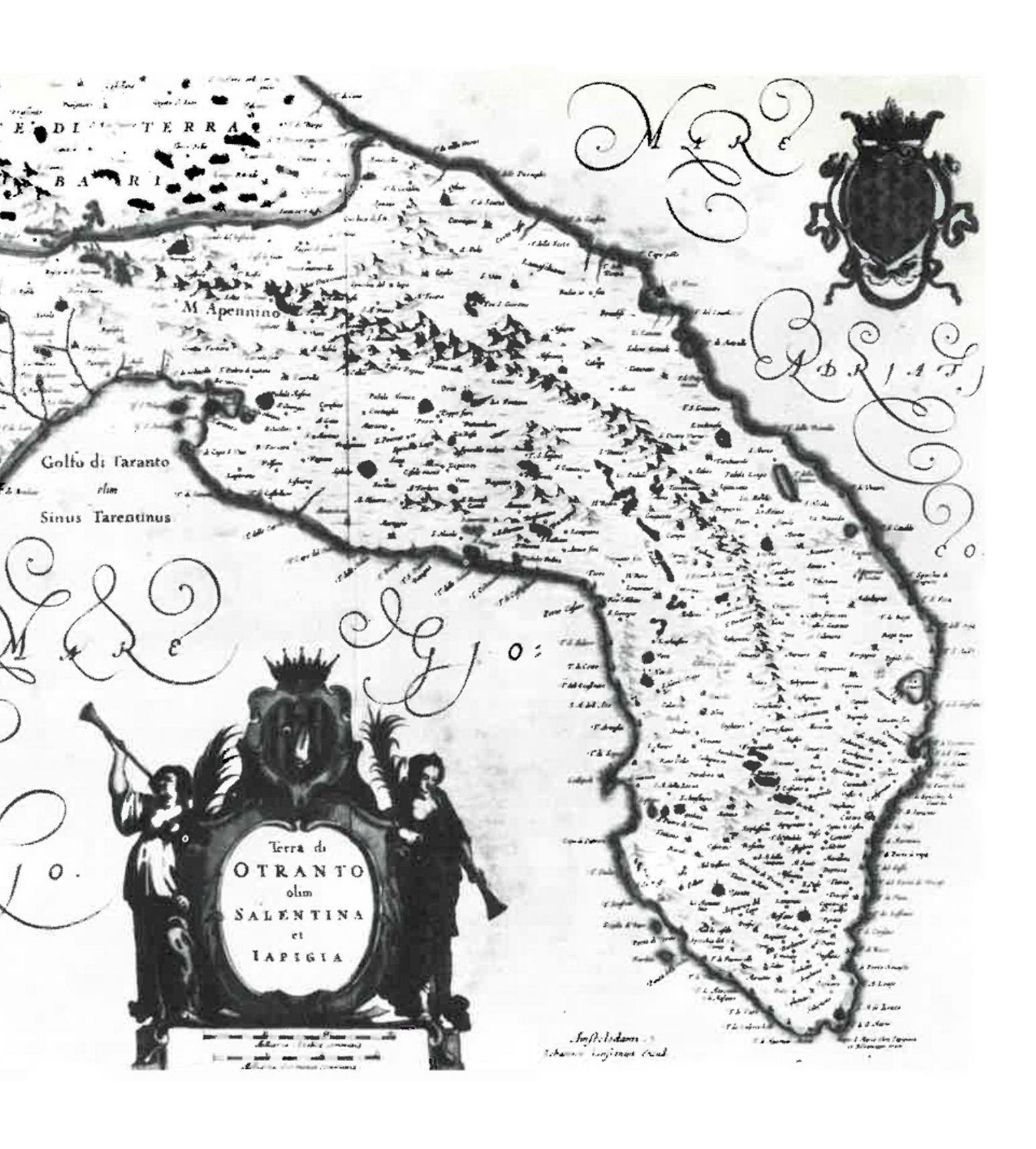
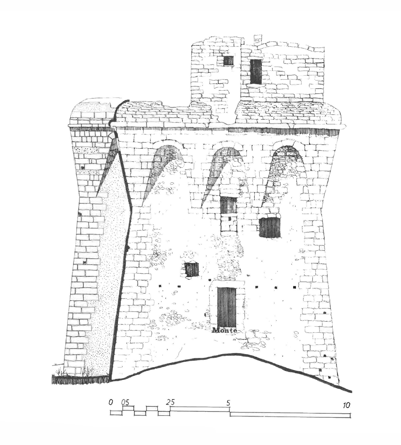
The coastal towers of Salento were built in response to the Turkish threat and the constant raids by Saracen pirates that, starting in the 15th century, terrorised the coastal populations. After the fall of Constantinople in 1453 and the conquest of Otranto in 1480, the Spanish viceroys launched a systematic construction plan: an unbroken chain of lookouts able to communicate with each other by sight, capable of raising the alarm along the entire coast in the time it took to send a smoke signal.

Each tower was a stone outpost, a permanent sentinel on the kingdom's maritime border. Today that same defensive line becomes the connecting thread of a route that crosses the coastal Salento in its most direct form.
57 Towers
57 Towers
The meaning

How to approach it

57 Towers lends itself to different ways of being experienced: it can be tackled in a sporting way, even competitively or for training purposes, or at a more relaxed pace, as a hiking experience accessible to families too.

The sea changes constantly along the route: the coast alternates shapes, colours and depths, moving from wilder natural settings to more developed coastal areas. The towers become the reference points of this continuous reading of the landscape.

Sporting
A linear route with measurable stages and precise distances tower by tower. Suitable for those who run, cycle continuously or want a concrete physical goal.
Hiking
The classic pace of those who walk or cycle without rushing, stop at the towers, explore the coves and manage the stages independently. The most common way.
Family
Short stretches, one or more towers a day, free pace. The route can be experienced in fragments, without losing the coherence of the system.
When

Travel times

57 Towers has no mandatory departure date nor an imposed pace. It can be tackled in spring when Salento is still quiet, or in autumn when the light on the sea changes every hour. The important thing is to start with a realistic estimate of the time available.

You can travel the entire route or choose individual stretches, building a tailor-made experience without losing the coherence of the route.

Complete
185 km
🚶
8 days
🚴
5 days
By stretches
30–40 km
🚶
1–2 days
🚴
3–5 h
Single tower
1–6 km
🚶
15–90 min
🚴
5–25 min
The journey

A traversable structure

57 Towers connects a complex territory, building a unified reading of it through the connection of landscapes, signs and identities. A structure that can be travelled according to different preferences and timings, continuously or in fragments, without losing its own coherence.

The route crosses 24 municipalities, each with its own coastal identity. A dimension that can only be fully understood by experiencing it: a journey that gives back what cannot be conveyed in words and which, in the Italian context, currently has no equivalent.

Porto Cesareo
4
towers
Starting point. Shallow waters and sandy seabeds on the Ionian side.
Nardò
7
towers
The longest stretch of the Ionian route. Jagged coast and hidden coves.
Sannicola
1
tower
Small stretch of coast between Nardò and Gallipoli.
Gallipoli
3
towers
Historic centre on an island, wide beaches and crystal-clear sea.
Racale
1
tower
Low coast with Mediterranean scrub, between Gallipoli and Leuca.
Alliste
1
tower
A single outpost on the line descending towards the Cape.
Ugento
2
towers
Dunes and protected natural areas among the wildest on the Ionian coast.
Salve
1
tower
Clear waters and free beach before the Cape.
Morciano di Leuca
1
tower
Last Ionian municipality. Rocky coast descending towards Leuca.
Patù
1
tower
A few steps from the meeting point of the Ionian and Adriatic seas.
Castrignano del Capo
3
towers
Here Salento ends. Santa Maria di Leuca is the turning point.
Gagliano del Capo
1
tower
First Adriatic tower. The coast changes colour and character.
Alessano
1
tower
Only coastal stretch, evidence of a widespread defensive system.
Corsano
2
towers
Cliffs and rough sea, one of the quietest stretches of the Adriatic.
Tiggiano
1
tower
Isolated outpost on a wind-battered coast between Corsano and Tricase.
Tricase
3
towers
Natural harbour and high cliffs. The most vertical stretch of the Adriatic.
Andrano
1
tower
Small port among the rocks with a view of the cove entrance.
Diso
1
tower
An outpost on the coastline that rises towards Castro.
Castro
1
tower
Medieval village on a promontory. The clearest sea of the Salento Adriatic.
Santa Cesarea Terme
4
towers
Sea caves, thermal baths and liberty-style villas. The most scenic stretch of the route.
Otranto
7
towers
The easternmost point of Italy. Seven towers defending the crossroads between West and East.
Melendugno
5
towers
Sandy beaches and open bays. The landscape stretches out towards the north.
Lecce
4
towers
The province of the baroque city reaches the sea. The final stretch approaches.
Squinzano
1
tower
Torre Specchiolla closes the route in northern Salento.
A journey that gives back
what cannot be conveyed in words.
In the Italian context,
it currently has no equivalent.
57 Towers 57 Towers

Begin your journey

Everything you need to walk 57 Towers — tower by tower, at your own pace — in a single package.

Start now →
What's included
📖
The Traveller's Passport
The official document of 57 Towers, in paper format. It arrives directly to your home before departure. Carry it with you and have it stamped tower by tower: at the end, you will have in your hands concrete proof of every kilometre walked.
🗺️
Complete GPX track
The entire route ready to load on any app or GPS. No uncertainty about the path, from Torre Castiglione to the last stage.
📍
Digital tower check-in
Each stage is marked as you pass through. Build a personal history of the journey that you can consult and share at any time.
📜
The history of each tower
For each stage, a historical and spiritual insight: you always know where you are, what happened there and why it is part of this route.
🏅
Route milestones
Digital achievements unlockable stage by stage. A simple way to keep track of how much you have walked — and to remember it.
Also included
🎁
Merchandise to win
Initiatives on our social accounts reserved for those who join: the chance to win exclusive items linked to our association.
🧭
On-route support
Transfers along the route, selected accommodation and organisational assistance stage by stage. For all of this, there is our official partner agency Salento Experience.